Home
ChangeAerial helps organizations transition from infrequent inspection of infrastructure (e.g., electric utilities, bridges, etc.) to regular monitoring. This is accomplished using ChangeAerial’s end-to-end workflow and N-SUITE software. The end-to-end workflow is shown below, including flight planning with
N-PLANNER, image analytics with N-SPECT and integrations for work actions.
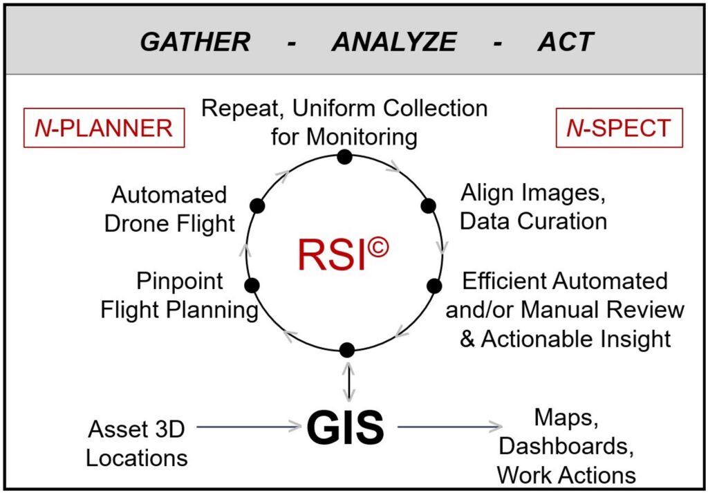
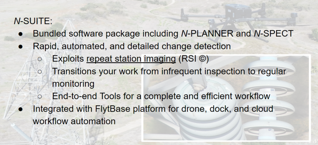
N-SUITE software bundle includes N-PLANNER and N-SPECT
to accomplish repeat station imaging (RSI ©) and effective monitoring
What more is there to know about N-SUITE software?
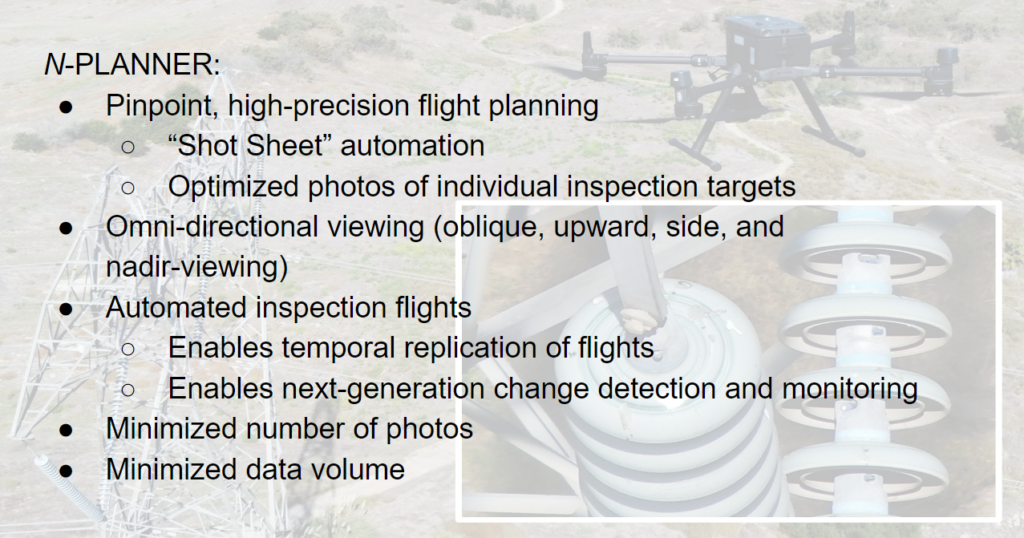
N-PLANNER is a novel flight and image capture planning software for uncrewed aerial systems (UAS). N-PLANNER is an add-in for ArcGIS Pro, and is available from the ArcGIS Marketplace. The benefits of N-PLANNER are shown below.
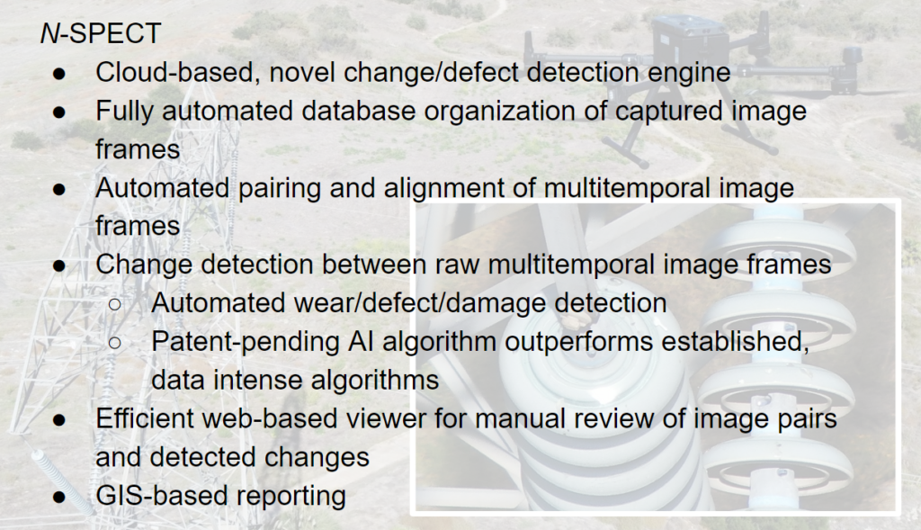
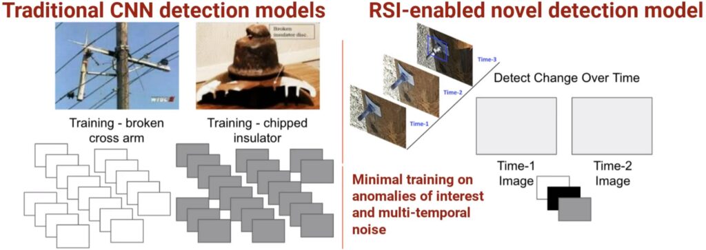
N-SPECT imports multitemporal RSI images, and performs data curation by preparing image frames for change detection. Advanced, AI-based change detection is utilized to automatically identify changes of interest (e.g., defects on electric utility infrastructure or other infrastructure). N-SPECT is web-based, with cloud processing and a custom viewer for reviewing AI change detection results and visualizing details within images over time. The benefits of N-SPECT are shown below.
Partners
ChangeAerial is partnered with Esri, FlytBase, and the Southern California Energy Innovation Network (SCEIN). N-PLANNER is an ArcGIS Pro add-in, and N-SPECT is an ArcGIS Experience Builder application.
Visit our FlytBase landing page to learn more about how FlytBase integrations via “Flinks” allow full automation of ChangeAerial’s end-to-end process, by integrating drones, drone docks, automated flight, and automated cloud-based data transfer with N-SUITE flight planning and analytics. In addition, FlytBase provides flight safety, fleet management, data security, and solutions for beyond visual line of sight (BVLOS) flight.
NSF SBIR Project
ChangeAerial was awarded a Small Business Innovative Research (SBIR) Phase-1 grant from the National Science Foundation (NSF). This grant is designed to fund high-risk, high reward research, adding to ChangeAerial’s already novel and innovative N-SUITE software tools. Read our news story to learn more.
CLICK “GET A DEMO” BELOW TO BE CONTACTED, LEARN MORE, AND GET A DEMO!
Contact
Please email info@changeaerial.com to discuss how we can help you to monitor the features that are important to you